Model
Kisakallio (number 1 on the area map)
Pine/spruce forest with mostly good visibility. Map scale: 1:4 000. Contour interval: 2 m.
Previous map: http://vaajakoskentera.com/kartat/show_map.php?user=ToniS&map=202&lang=nb
http://www.kartta-arkisto.net/show_map.php?user=SamiH&map=168
PreO 1
Luukkaa Recreational Area (2)

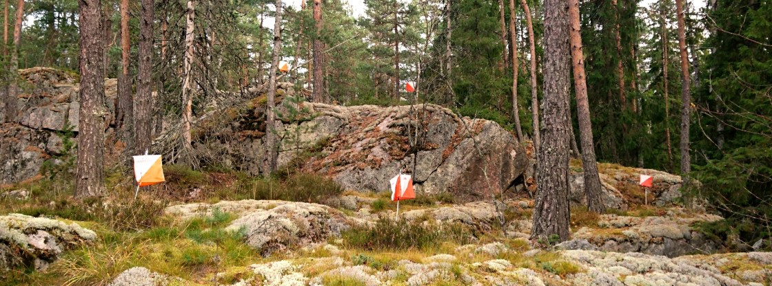
A typical Finnish forest with a mixture of spruce and pine trees. In parts, bare rock/cliff areas. Medium to good visibility. Map scale: 1:4 000. Contour interval: 2 m.
Previous map: https://reitti.helsinginsuunnistajat.fi/cgi-bin/reitti.cgi?act=map&id=244#
PreO 2
Snettans Estate, Röylä (2)

A pine/spruce area typical of the famous Noux National Park. Mostly hilly terrain with hill slopes/tops with good visibility. Predominant features are bare rock areas and hillsides with lots of rock faces. Map scale: 1:4 000. Contour interval: 2 m.
Previous map: https://reitti.helsinginsuunnistajat.fi/cgi-bin/reitti.cgi?act=map&id=244#
Tempo Qualification
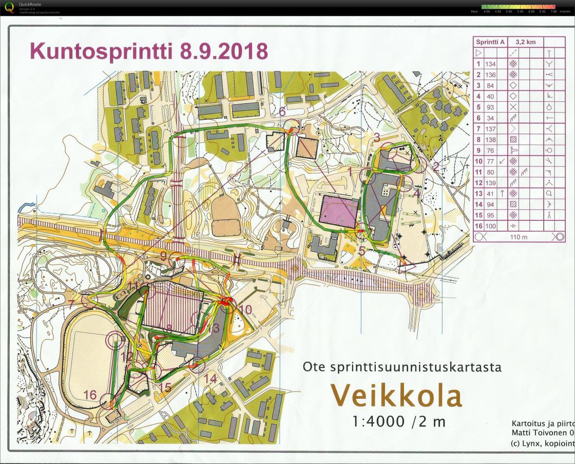
Veikkola (6)

A suburban area with a mixture of open, park-like areas and forest islands among official buildings and living quarters. Map scale: 1:4 000. Contour interval: 2 m.
Previous map:
TempO Final
Veikkola (6)

Partly park area, partly forest. Forest with good visibility, in parts steep and rich in cliffs/rock faces. Map scale: 1:4 000. Contour interval: 2 m.
Relay
Oittaa (3)
A typical Finnish forest with a mixture of spruce and pine trees. In parts, bare rock/cliff areas. Medium to good visibility. Map scale: 1:4 000. Contour interval: 2 m.
Previous map: http://www.ok77.fi/routegadget/rg2/#11